Introduction
The ACT Government lodged two Development Applications for light rail on 23 October 2015:
- Stage 1 from Gungahlin to Civic, DA 201528511
- Stage 2 from Civic to Russell, DA 201528508
Public submissions on these DAs were accepted between 28 October 2015 and 18 November 2015, and then notices of decisions approving the applications were made by the ACT Government for Stage 1 and Stage 2 on 21 December 2015. The ACT Government had already amended planning legislation to exempt development applications related to the light rail project from the normal appeal and review processes.
I submitted a response to both development applications. Although the issues raised in that submission were not adequately addressed in the decisions, the removal of the normal review process meant there was no reasonable formal mechanism to challenge the decisions.
Below are extracts of the development application decisions (linked to in full above) with my commentary which would otherwise have been submitted to a review of the decisions.
Stage 2 Decision
Many of the issues raised in the submission and assessment are common to both stages, and are discussed here in the Stage 2 Decision notes.
Page 10
The DA assessment fails to recognise that there are 24 formal crossings on the 12km of the Stage 1 tram line, each providing a potential for an accident.
The DA assessment fails to recognise that despite a "clear sight in the direction of travel", a tram travelling at the proposed 70km/hr along Flemington Rd will take almost 100m to stop under ideal conditions using its emergency brake, 25m further than a laden semi-trailer and 38m further than a car travelling at the same speeds, both of which also have the ability to swerve and the advantage of less mass and hence kinetic energy [more information]. Hence an "appropriate reaction to hazards and situations" will be much less effective than current transport (cars, buses, trucks) along the route without appropriate mitigation such as a fully fenced route and crossings with boom-gates.
The DA assessment fails to recognise that the 10 new signalised intersections on the Stage 1 route and tram priority at these and existing intersections is shown by the Capital Metro Agency (CMA) Envoronmental Impact Statement (EIS) to be largely responsible for the increasing congestion on the road network. Even using CMA (demonstrably over-optimistic) forecasts from the EIS, average vehicle speed decreases from 27.8 km/hr in 2021 if the project does not go ahead, to just 23.1 km/hr in 2021 if the project does go ahead. That is, the wider network road traffic speed will be over 20% higher in 2021 if the project does not go ahead. On the route itself, using data from the EIS model to correct for the acknowledged errors on peak period route timings, the commuter trip round time from Gungahlin to Civic (AM peak) and return (PM peak) in 2021 will be around 15 minutes longer if the project goes ahead.
The DA assessment fails to recognise that the CMA EIS shows that the cumulative delays on intersections on the route for road traffic are increased by 44% in 2021 with the project compared to 2021 without the project, causing an extra 191 kilolitres of fuel to be burnt by idling engines and an extra 725 tons of carbon-dioxide to be emitted annually [more information]. (The CMA EIS acknowledges that additional delays will occur at intersections on feeder roads crossing the route, but the additional delays, fuel and carbon-dioxide they will cause have not been quantified.)
Capital Metro say that the Gungahlin-Civic tram will travel at the road speed limit along the route (mostly 60 and 70 km/hr), achieving average journey speeds almost double those of Melbourne's trams, and much faster than even the new Gold Coast tram. Indeed, if they gain approval from the rail safety regulator, average journey speeds will be about the same as Melbourne's "heavy rail" trains. Without this approval, the business case, based as it is on double-counting of tram travel time savings and ignoring road congestion, falls apart.
Melbourne's trains are separated from traffic at road intersections, mostly by tunnels and bridges, but sometimes by level crossings; normal signalised intersections do not provide adequate safety. But these level crossings are so dangerous and congestion-causing that the Victorian Government is spending $2.4 billion to remove 20 of them by 2018, and will spend more to remove 50 by 2023. Yet Capital Metro propose 23 road crossings on their route, across many of Canberra's busiest intersections, none with tunnels, bridges or even the basic protection of a level crossing.
Capital Metro is disingenuously proposing to provide a heavy rail service with light rail infrastructure. Based on Melbourne's experience, fixing the resulting safety and congestion problems will cost much more than the initial project.

- The DA assessment fails to recognise that the tram capacity and frequency specified in the CMA EIS and DA will mean:
- a significant reduction in peak period public transport capacity along the route (4828 on ACTION buses in 2015 between 6:30am and 9am on routes between Gungahlin and Civic to be replaced by tram, compared to 4508 in 2021 on the tram on the same route and same AM commuter peak; that is ACTION has over 7% more capacity in 2015 than the tram will have in 2021 on this route)
- a large reduction in "per Gungahlin resident" peak period public transport capacity along the route taking into account population growth between 2015 and 2016 (79.9 per 1000 Gungahlin residents with ACTION buses in 2015 between 6:30am and 9am on routes between Gungahlin and Civic to be replaced by tram, compared to 61.8 per 1000 Gungahlin residents on the tram in 2021 on the same route and same AM commuter peak; that is ACTION has over 29% more "per resident" capacity in 2015 than the tram will have in 2021 on this route)
- a huge reduction in "per Gungahlin resident" peak period public transport SEATED capacity along the route taking into account population growth between 2015 and 2016 (51.1 per 1000 Gungahlin residents with ACTION buses in 2015 between 6:30am and 9am on routes between Gungahlin and Civic to be replaced by tram, compared to 18.9 per 1000 Gungahlin residents on the tram in 2021 on the same route and same AM commuter peak; that is ACTION has over 170% more "per resident" SEATED capacity in 2015 than the tram will have in 2021 on this route)
Because total and particularly SEATED public transport capacity is so much lower with the tram, CMA's own modelling shows that public transport will fail to gain significant "mode share" with population growth (and public transport "mode share" will probably be reduced), forcing commuters to their cars.
The DA assessment fails to recognise that the tram capacity and frequency specified in the CMA EIS and DA will mean a significant reduction in the bike-carrying capacity of public transport during commuter peak period along the route (120 on ACTION buses in 2016 between 6:30am and 9am on routes between Gungahlin and Civic to be replaced by tram, compared to 92 in 2021 on the tram on the same route and same AM commuter peak; that is, in 2016, ACTION will have over 30% more bike-carrying than the tram will have in 2021 on this route).
The DA assessment fails to recognise that with much longer distances between stops, and and increased necessity for transferring between buses and trams, the proposed tram will increase, not reduce obstacles to public transport use for the elderly and people with disabilities, shopping carts and prams.

- The DA assessment fails to acknowledge that the CMA DA contradicts this assessment, clearly warning of adverse impacts:
"Forecasted traffic demands along London Circuit and Constitution Avenue, particularly between London Circuit and Coranderrk Street intersections, for the 2031 scenario resulted in substantial delays and queueing. It was assumed that demand forecasts could not be realised due to the constrained nature of the corridor, and therefore manual manipulation were made to route choice and traffic volumes to alternate routes. This represents a risk to the Project and wider road network."
[Appendix C of the Stage 2 Development Application, "Russell Extension Traffic and Transport Impact Assessment", 4.1.1 Model Assumptions, page 22]And with regards to the Northbourne Avenue, Barry Drive and Cooyong Street intersection, the same document also clearly warns of adverse impacts:
"Considering this western approach and exit was already operating at or near LoS F in Stage 1, increasing the number of vehicles using Barry Drive is considered a risk as queues and delays for these vehicles will extend further. ... In addition to delays on the side approaches, observations of the model showed queueing on northern approach (Figure 4.1). With an increase in the number of vehicles turning right from Northbourne Avenue (SB) to Barry Drive (WB), vehicles waiting to turn right extended beyond the auxiliary lane, hence also blocking the adjacent traffic lane, worsening delays for other movements. As the intersection deteriorates in performance, there is the possibility that vehicles will opt to use the proposed Vernon Circle - Edinburgh Avenue connection to reach their final destination. Unfortunately, since the demand matrix in the model is manually adjusted (compared to a comprehensive model with all road connections) that would change dynamically based on capacity, the impacts to other locations may be underestimated. Such locations include the Northbourne Avenue/London Circuit intersection as well as Vernon Circle."
[4.3.1.1 Intersection of Northbourne Avenue, Barry Drive and Cooyong Street, page 26]These admissions could not be much clearer and the same document even attempts to make a virtue of "compromised performance":
Traffic modelling of the Project scenario found that introduction of the light rail corridor within the City extent of the network generally leads to impacts to general traffic. Whilst some impacts are expected and in some instances encouraged to facilitate a mode shift to public transport, in several locations delays and queues could result in a compromised performance of the wider road network."
[Executive summary, page vi]
Page 11
As shown above, the capacity on the Gungahlin to City route falls significantly in 2021 with the project compared to the current ACTION network. Hence, the proposal reduces public transport amenity and so fails to meet zone object "c".
Page 15 and 16
Capital Metro have modelled a 15 minute journey time from Civic to Russell on the 3.2km proposed Stage 2 light rail extension (average speed: 12.8km/hr). Promotion for the extension claimed it would remove the lunch-time "isolation" of workers in Russell. The light rail will offer 6 services running each way per hour at lunch-time (compared to the current 10 ACTION bus services per hour at lunch-time). Before road-works started on Constitution Avenue, the ACTION Bus trip time was just 8 minutes. Hence, the proposed light rail will not only reduce service frequency (and seats) but will also result in an 88% increase in journey time, increasing the occurrence of lunch-time isolation syndrome.
Additionally, the Stage 2 DA acknowledges congestion on and around the network will greatly increase, clearly warning of "compromised performance of the wider road network" that "represents a risk to the Project and wider road network" should the Stage 2 proceed.
The DA Assessment has failed to discuss and heed these warnings from the very body submitting the DA.
Page 16
As noted above, journey times during lunch hour increase from 8 minutes on ACTION before the current Constitution Av road works, to 15 minutes by tram - an 88% increase in journey time.
The note above implies that as this is not a peak period comparison, light rail's greatest benefit is not been fairly represented in my submission. This implication is unfounded.
From an ACTION timetable from early 2014 (before Constitution Av construction) for a typical peak period City - Russell route, the 701 to Barton from Spence ( https://web.archive.org/web/20140406085614/http://www.action.act.gov.au/routes/xpresso/701_barton ), the peak period journey times leaving Civic at 7:31am, 8:20am and 8:34am are all 9 minutes (and there are dozens of other services on other Route numbers along this path, all with 9 minute journey times in AM peak).
Hence, journey times during AM commuter peak increase from 9 minutes on ACTION before the current Constitution Av road works, to 15 minutes by tram - a 67% increase in journey time.
The DA assessment fails to recognise that for the majority of commuters travelling from North Canberra/Belconnen to Russell, their journey time will increase by much more than the above-computed 67% because they will now have an additional mode change from bus to tram in Civic, with an associated walk and average 3 minute wait for the tram. Assuming a 3 minute bus disembark and walk-to-tram, it can thus be expected that the Civic to Russell leg of their journey will take an extra 12 minutes (3 minute walk, 3 minute wait, 6 minute extra journey time) each way, or an increase from 9 minutes to 21 minutes, an increase of over 130%. Over a year of 220 two-way journeys, the average commuter from North Canberra/Belconnen will waste 88 hours of commuting time due to the Stage 2 proposal (12 minutes per leg, 2 legs per day, 220 days per year). The Stage 2 Business Case will need to represent this cost (over $1500 pa per commuter, or $45k per commuter over the project life...)
The DA assessment has failed to take into account the greatly increased journey times on this route, both peak and off peak, which reduce the utility and attractiveness of public transport on this route. Hence, the proposal reduces public transport amenity and so fails to meet zone object "c".
The DA Assessment has not considered the representation from Kent Fitch which demonstrates the much higher level of service provided by ACTION buses compared to the proposed tram over the AM commuter period 6:30am to 9:00am. The DA Assessor should note that the capacity advantage of the ACTION service over the tram service is uniform over this period - that is, any one hour interval between 6:30am and 8:30am demonstrates similar capacity findings, namely, ACTION provides a service with significantly more capacity and convenience than that provided by the proposed tram. Whilst theoretical speeds on some peak tram services between Gungahlin and Civic may be faster than some current (actual) timetabled ACTION services, the DA Assessor should note that these speeds are contingent on yet-to-be-approved operational speeds, that the theoretical speeds proposed by CMA are much higher than those achieved on the recent Gold Coast and entirely-segregated Dulwich Hill light-rail extensions, and out of peak periods and against the peak "flow", the current "express" ACTION journey times are consistently faster than the theoretical tram journey times.
With regards to the Stage 2 link between Civic and Russell, ACTION services (pre Constitutional Av roadworks) are considerably faster than tram (peak and non-peak), and that advantage that will be only increased when Constitutional Av is returned to service in 2016 with dedicated bus lanes.
Page 16 and 17
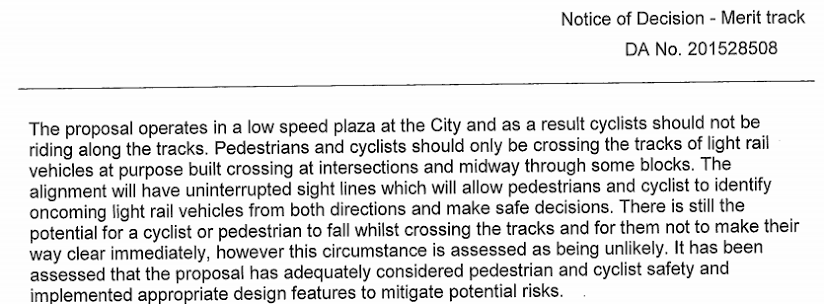
The DA Assessment fails to note the emphasis on the poor emergency breaking capability of the tram, and its inability to swerve to avoid a collision. Specifically, it fails to acknowledge that if a B-Double truck had the limited emergency braking capability of a tram, it would be considered unroadworthy, yet the DA proposes running vehicles every 3 minutes (counting both directions) across 24 intersections on the Stage 1 route, the busiest road corridor in Canberra.
Page 18
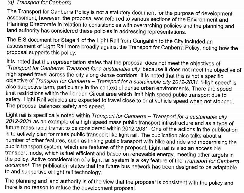
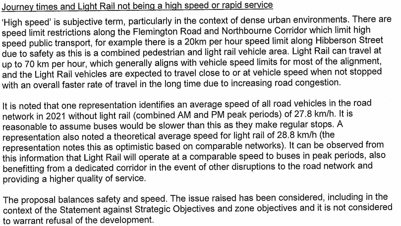
The DA Assessment fails to recognise that "high speed" (and "rapid") is defined in the "Transport for Canberra" policy as at least 40km/hr in Action Item 17:
"Adopt an operating speed standard of 40km/hr for the rapid service to guide the infrastructure investment program [within 2 years]"
This document defines where this rapid service is required in Table 2 on page 19:
"Public transport corridors for all day, high speed travel across the city along dense corridors. Analogous to a metro or rapid public transport system, and location for future light rail or bus rapid transit. Rapid services carry the majority of passengers, and can help achieve mode shift goals for work trips and associated emissions reductions."
Hence the "Transport for Canberra" policy is clear that as a transport corridor using light rail or bus rapid transit, the Gungahlin-Civic transport corridor should provide a speed standard of 40km/hr.
As even the optimistic (and unapproved) journey speeds of 28.8km/hr fall far short of this government policy, the DA clearly fails to meet the required speed.
It is noted that the DA assessment states that the "Transport for Canberra" policy is not a statutory document. However, it is the Government's transport policy, and hence provides the best and most applicable context available for assessing whether the DA meets the TSZ1 requirement for "Make provision for a transport network that can provide for the efficient, safe and convenient movement of people and goods". Capital Metro's National Capital Plan Works Approval (for Stage 1: Gungahlin to Civic - Federal Highway and Northbourne Avenue) Planning Report (Feb 2016) describes "Transport for Canberra" as "the Territory's transport planning policy document":
"Transport for Canberra - Transport for a sustainable city 2012-2031 (Transport for Canberra) was published in March 2012 (ESDD, 2012b). Transport for Canberra is the ACT Government's strategy for a more effective and efficient transport system to meet the needs of the community while reducing the environmental impacts of transport. It is the Territory's transport planning policy document and replaces the 2004 Sustainable Transport Plan (ACT Government, 2004) and is aligned with the land use plans and policies outlined in the ACT Planning Strategy (ESDD, 2012a)"
[Section 3.2.6, page 18]
As such, it presents the policy criteria against which the development application must be assessed. Falling so far short of the rapid transport requirement of 40km/hr (optimistically 28.8km/hr between Gungahlin and Civic, 12.8km/hr between Civic and Russell) means that the proposal is inconsistent with the Government's transport policy.
Stage 1 Decision
Page 29
Page 30
Page 31
The DA Assessment incorrectly calculates the existing bus service as having a peak period capacity of 1300 per hour.
The ACTION web site contains "Google Maps Transit Feed" data used by Google to provide bus info/schedules on Google Maps ( https://www.action.act.gov.au/rider_Info/apps ). This data set contains locations of stops, all services and when each service arrives and departs at each stop. It contains information for many periods, such as regular weekday, weekends and the current holiday timetable.
Extracting information from this "data feed" is straight-forward: here is an extract as December 2015 of weekday services from Gungahlin to Civic (southbound). The columns are departure time, arrival time, route number, elapsed (journey) time.
Using this information and an ACTION-bus average of 71 people per bus (45.4 seated 25.6 standing):
| Period | Services | Passengers |
|---|---|---|
| 06:00 - 06:29 | 6 | 426 |
| 06:30 - 06:59 | 10 | 710 |
| 07:00 - 07:29 | 13 | 923 |
| 07:30 - 07:59 | 17 | 1207 |
| 08:00 - 08:29 | 13 | 923 |
| 08:30 - 08:59 | 14 | 994 |
So, if CMA wishes to define "peak period" as 7:00:7:59, or as 7:30-8:29, ACTION current capacity is 2130 passengers in these hour periods.
The DA Assessment Stage 1 page 31 incorrectly states this figure is 1300 passengers per hour in peak, noting that this is less than the "up to 2000 persons" per hour carried by the tram.
Perhaps the DA Assessment mistakenly computed the 1300 capacity by only counting the "red rapid" 2xx routes: there are 18 of these per hour from 7am under 9am, which on average can carry around 1280 people in aggregate (perhaps more if higher-than-average capacity buses are used on these popular routes).
However, because all the bus routes between Gungahlin and Civic are being replaced, the assessment must also include the route 56, 57 and 58 services which carry passengers from the Gungahlin suburbs along the route into Civic; when these services no longer continue to Civic, these passengers will need to transfer to the tram somewhere in Gungahlin.
There are 12 route 56, 57 and 58 services between 7am and 7:59am, and 9 between 8am and 8:59am. When these are included, ACTION capacity is 2130 passengers per hour in 2015, compared to "up to 2000" on the tram in 2021.
When population growth is considered, the tram capacity is much smaller percentage of the Gungahlin population in 2021 than the current ACTION capacity, and when seats are considered, things are even worse for the tram ( TramsForCanberra/tramsAndCanberra.html ).
If attention is directed to seated rather than total passengers, the tram service looks even worse. ACTION's average seated capacity is 64% of total capacity Capital Metro is uncertain: the DA diagrams indicate 48 seated plus up to 12 flip-up seats, which are shared with space for bikes and wheelchairs. So, if no bikes or wheelchairs, 60 out of the 200 (30%) could be seated.
Hence, during peak hour, 64% of 2130 ACTION bus passengers would be seated (1363 bus passengers seated), compared with just 30% of 2000 on the tram (600 tram passengers seated).
Off-peak, 64% of 497 ACTION bus passengers would be seated (318 bus passengers seated), compared with just 30% of 800 on the tram (240 tram passengers seated).
Page 32
The representation from Kent Fitch included data from the greenhouse impact of construction detailed in the development application. The so-called "mitigation measures" referred to above are unquantified and short of detail, and do not provide any basis for assessment. Is the DA Assessment assuming the over 60,000 tons of greenhouse gases will be reduced by some specific amount? If so, this unpublished figure could be used to recalculate the impacts. However, even if it is reduced by 20%, the "pay back" time is still over 30 years assuming no reduction in alternative transport emissions during that period (that is, assuming electric vhicles will not increase their share and that Australia will not adopt EU emission standards, both extremely unlikely assumptions).
By what amount will the construction emissions fall? How will these changes affect the implementation costs and timetable? This information is not available in the EIS or its amendment, or the most recent applicable document, the development application. The DA Assessment must consider the published information in the development application and its supporting documents.
The representation referenced (if it is mine) does not need to (and should not, in order to perform a like-for-like comparison) consider "impacts associated with road construction" (for the EIS model assumed there are none with the "no project" case). I do not understand what, "road maintenance for bus operations" means - is it implying that the relatively small bus traffic on Flem/NorthB (compared to cars, trucks, semis) means extra road maintenance with accompanying greenhouse gas emissions to perform that maintenance? I suspect this might not be my representation anyway, because it did not mention/canvas bus rapid transport in the median. And I certainly did fully consider and cost the positive aspects achieved by the small modal shift from cars to tram modelled by CMA.
The DA assessment fails to note that car and bus transport emissions are very likely to drop sharply due to the Australian adoption of EU emission standards in 2018, and the move to electric vehicles with zero tail-pipe emissions.
The DA assessment inappropriately refers to other "life-cycle models" for emissions from light-rail rather than evaluate the data presented by the CMA DA and EIS on the emissions associated with this particular development. In particular, the DA assessment fails to note the extremely small "mode shift" from cars to tram modelled by CMA, and the dramatic reduction in public transport capacity and utility resulting from the replacement of ACTION buses on the Gungahlin to Civic and Civic to Russell routes which will tend to reduce mode-shift even further, and fails to consider the increased emissions caused by congestion along the route directly attributable to the project (as modelled by the CMA EIS).
Page 33
With regards to "However the overall travel time given by the representor.. the time difference ... would be lower had it not considered positive impacts associated directly with the works proposed as part of this proposal":
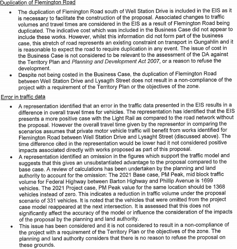
The DA assessment states under "Duplication of Flemington Road", these works are UNCOSTED in the business case and will happen "in any event" regardless of the project. Hence, a "like for like" comparison must assume the duplication in both cases, or assume it doesn't happen in both cases. My representation took the second option, but the time differential would be almost identical in either case. The CMA EIS included this duplication because it relieved a huge problem they had with car travel times if the light rail is built. Quoting from their EIS Addendum Report, August 2015, page 19 when responding to EPD's query about the duplication:
"In the Project Case, this section of Flemington Road is proposed to be upgraded to two lanes south of Well Station Drive, removing the congestion, and resulting in the Project Case performing better than the Base Case."
This resulted in a 9min31second "advantage" for the light rail travel times on the Gozzard to Wells Station part of the route according to the CMA EIS model. I could have removed this advantage for light rail case (assuming no duplication), or also provided it to the no-light-rail case, which I did. Either action gives a "like for like" comparison, and because the duplication is UNCOSTED, doing either is fair and reasonable [more information].
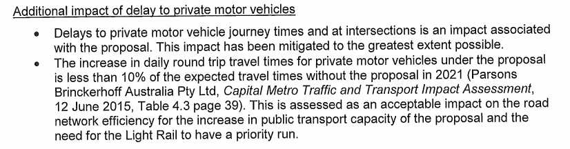
With regards to the DA Assessment assertion that ignoring a huge error in traffic data in part of the CMA EIS model (noted by TAMS) "does not significantly affect the accuracy of the model", my representation demonstrated that it increases the car commuter travel time for the "tram" model by almost 2 minutes, increasing the CMA EIS estimate of the car commuter round trip time from 55:23 to 57:15. When combined with the attempted road duplication fiddle, which added over 9 minutes to the car round trip estimate for the no-light-rail estimate, these "errors" in the DA mean that the commuter round-trip car journey time between Gungahlin and Civic will be around 15 minutes longer if the project goes ahead. When this lost time is multiplied over the millions of commuter journeys undertaken each year, these error represents a very significant effect on the "accuracy of the model" which the DA Assessment needs to consider.
As noted above, these delays are extensive and will affect tens of thousands of travellers and millions of journeys each year. The cost of these delays was not included in (or even acknowledged by) the CMA Business Case, because in aggregate they swamp the negligible (and possibly non-existent) travel time savings attributable to light-rail users. As such, the DA Assessment should consider their true impact.

Canberra Autonomous Car Simulation by Kent Fitch is licensed under a Creative Commons Attribution-NonCommercial 4.0 International License.